Joshua Cheek

For many of us city-dwellers, our lives would be unimaginable without Google Maps. We use it for everything, from road trips to finding the route to restaurants and friends’ homes. But many of us tend to forget that GPS is only as good as the map, and fewer still stop to consider the number of people, the amount of work, and the years of innovation and dedication that it took to create the world map as we know it today. To study the evolution of map-making is, in essence, to study the evolution of human knowledge.

India by night, courtesy of NASA. Photo: NASA Earth Observatory by Joshua Stevens
Give me some curves, already!
Until around the second century, when Ptolemy wrote his seminal book, Geography, the world was always illustrated as flat. The Greco-Roman philosopher was among the first to record the world as a sphere. Sadly, none of the maps from Ptolemy’s original book have been found—but we do have a vivid, blue map, created by a group of Byzantine monks somewhere in the 12th century using the descriptions from Ptolemy’s book. The biggest hurdle that the monks faced, was how to flatten a sphere onto a sheet of paper without distorting the image. It is a problem that haunts mathematicians and cartographers even today.

The recreation of Ptolemy’s map, which was deeply flawed but significant nonetheless. Don’t miss India in big, bold letters, and the Ganges snaking across her breadth. Photo: WikiCommons
Of course, size matters!
Fast forward to 1569 when Gerardus Mercator created a world map that managed to illustrate the distance between landmasses. He accomplished this by using latitude and longitude as straight lines, allowing for more accurate navigation and making his map a hit with sailors around the world. Gerardus’s representation might be the most influential map in history, and the one we are most familiar with—it’s the one in most of our school textbooks. He also introduced the term “atlas” for a collection of maps. But Gerardus’s map is not without its flaws. The distances might be relatively correct, but the size of many landmasses is wrong. For example, Greenland is shown roughly the same size as Africa, when in fact, the African continent is vastly larger than Greenland. Europe appears slightly larger than South America, which is also grossly incorrect. Some say, this was because his map was born in the colonial era, when the white world ruled most of the globe, and his work reflects this. Others argue that while this might be the case, Gerardus’s map is still the most accurate world map available today.

Gerardus Mercator’s original map from 1569. Photo: WikiCommons
Shaping our world view
In 1967, German historian Arno Peters devised a new map to rectify the errors in the popular design. Arno claimed that his version depicted the correct sizes of the continents in relation to each other. By illustrating all countries in their true size and location, Arno’s map shows each one’s actual position in the world, minus political and historical baggage. The map—shown below—seems oblong in parts and stunted in others. Africa is decidedly larger, North America has been cut down to size, and India too, seems like a thinner version of herself. It seems strange at first, but that’s only because we have grown up with a different picture of our world.
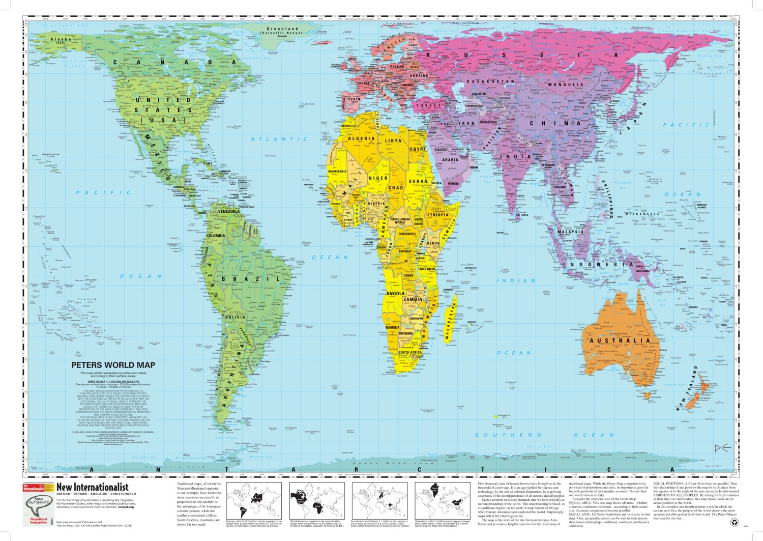
The official Peters Projection map has been promoted by the UN, and by some educational institutions. Photo: Oxford Cartographers.
That’s the thing about maps. We think of them as hard fact, but all maps are the product of human endeavour, and therefore subject to the inherent bias of the map-maker in particular, and society as a whole.


United States
+1 (425) 454-2113
1756 114th AVE SE
Bellevue, WA 98004
India
+91-11 39585644
IT C-7 KMG Tower
2nd Floor, Sector 67,
SAS Nagar
Mohali – 160062, Punjab